Plane & Pilot Photo Of The Week: Western Wildfires From Space

Western Wildfires from Space
A satellite image of the wildfires in the western part of the U.S. Photo courtesy of NASA
Gemini Sparkle

Key Takeaways:

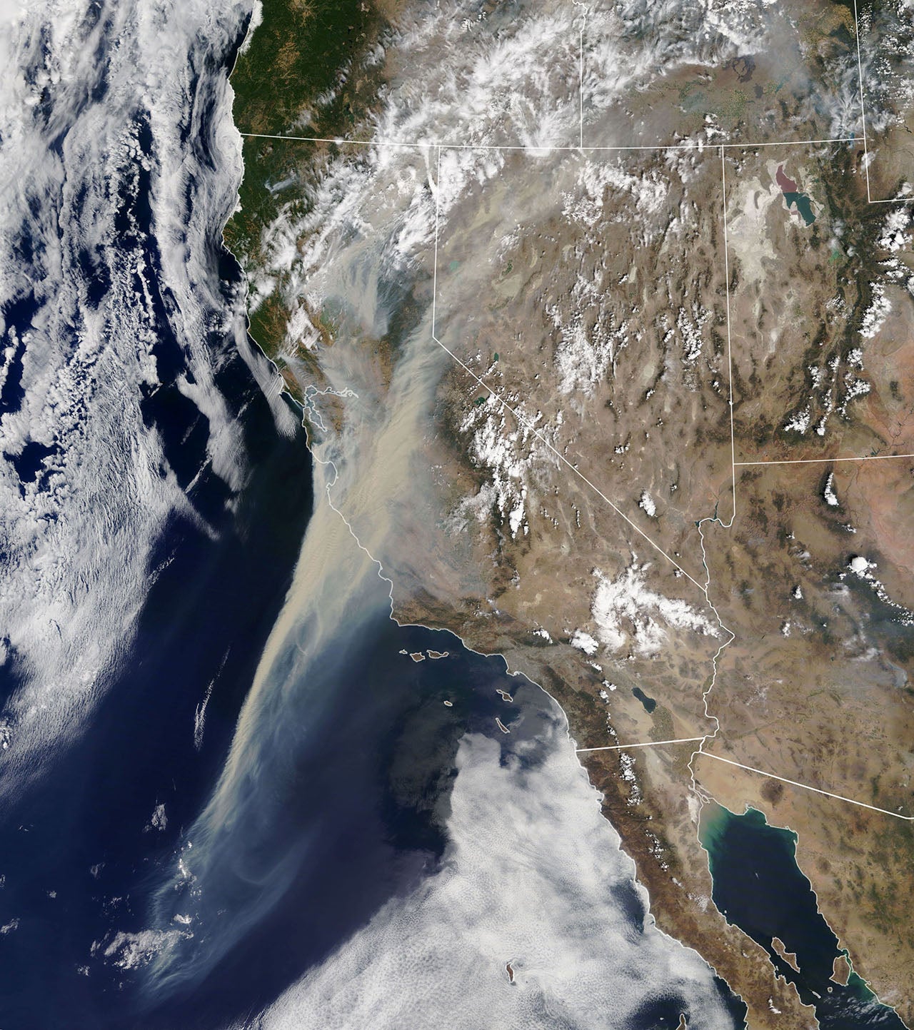
This week’s Plane & Pilot Photo Of The Week is a devastating one—a satellite image courtesy of NASA that shows great extent of the smoke created by the dozens of active fires burning in the Western United States.

The photo shows that smoke reaching at least 500 miles from the California shore. There are literally hundreds of fires burning, at least 370 in California alone.

Plane & Pilot

Plane + Pilot is general aviation’s only adventure-based magazine. From where to go, to how to get there, and everything in between, your next great adventure awaits.
Subscribe to Our Newsletter

Get the latest Plane & Pilot Magazine stories delivered directly to your inbox

SUBSCRIBE