Photo of the Week: Oklahoma Mammatus

Dozens of Oklahomans posted pics of bizarre cloud formations to social media as rare and spectacular mammatus formations appeared following a severe storm

Photo of the Week: Oklahoma Mammatus
Photo of the Week: Oklahoma Mammatus Photo by Ravi Karkara
Gemini Sparkle

Key Takeaways:

  • The article features "Photo of the Week" showcasing spectacular mammatus cloud formations observed in Oklahoma.
  • Mammatus clouds typically form during the weakening phase of powerful storm systems, often associated with tornadic activity.
  • These unique cloud formations result from dissipating convection, where sinking air creates distinctive, heavy-looking, pouch-like pockets.
See a mistake? Contact us.
Photo of the Week: Oklahoma Mammatus
Photo of the Week: Oklahoma Mammatus. Photo by Ravi Karkara

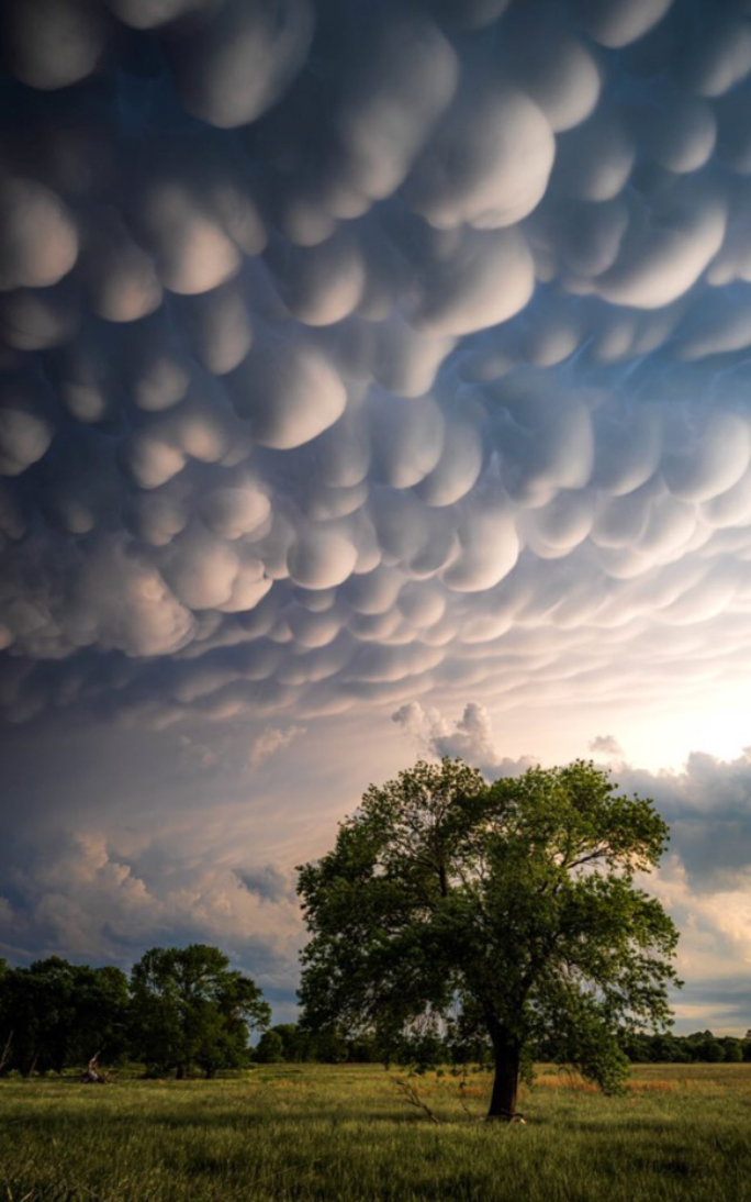
Our Plane & Pilot Photo of the Week is one of dozens we found that showcased the spectacular, surreal beauty of mammatus cloud formations in Oklahoma last week. Mammatus clouds are usually formed in the weakening phase of a powerful storm—there were, indeed, tornados that were spawned by this system. As the power of the convection dissipates, the sinking air forms what look to be stretchy pockets filled with heavy material. In a sense, that’s exactly what they are! This remarkable shot of mammatus clouds was posted by Ravi Karkara. Great shot, Ravi!

Outrageous mammatus clouds under a severe thunderstorm in Oklahoma pic.twitter.com/hhbB2BOGYU

— Ravi Karkara (@ravikarkara) May 16, 2022


Do you want to see more great aviation photography?  Check out “Nate and Ollie Read World’s Best Aviation Magazine.”

Plane & Pilot

Plane + Pilot is general aviation’s only adventure-based magazine. From where to go, to how to get there, and everything in between, your next great adventure awaits.
Subscribe to Our Newsletter

Get the latest Plane & Pilot Magazine stories delivered directly to your inbox

SUBSCRIBE