











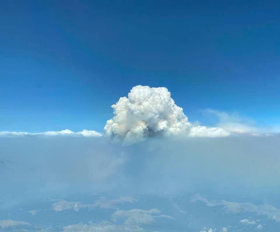

Our Plane & Pilot Photo Of The Week: What‘s A Pyrocumulus Cloud?

One of the oddest weather phenomena caught in full bloom.

Pyrocumulus Cloud
Gemini Sparkle

Key Takeaways:

  • The Plane & Pilot Photo Of The Week showcases a pyrocumulus cloud (cumulonimbus flammagenitus), which forms from the heat and instability generated by surface fires.
  • The featured photo was taken at 21,000 feet between Fort Collins and Denver, Colorado.
  • In rare instances, pyrocumulus clouds can produce enough rain to extinguish the fires that create them.
  • Unfortunately, this did not happen with the fire associated with the cloud in the photo, which itself was retouched to remove bug spots.
See a mistake? Contact us.

This week’s Plane & Pilot Photo Of The Week is of a pyrocumulus cloud, otherwise known as a cumulonimbus flammagenitus. This cloud type is formed by fires burning on the surface. Heat rises, causing instability, which in turn causes the cloud to form. This photo, from a source who chose not to be credited (but thank you anyway), was taken between Fort Collins and Denver, Colorado, at 21,000 feet.

In rare instances, pyrocumulus clouds have been known to rain so hard that they put out the fire that created them. Unfortunately, this did not happen in this instance.

Note: The photo was retouched, but only in order to remove numerous bug spots on the windscreen.

Plane & Pilot

Plane + Pilot is general aviation’s only adventure-based magazine. From where to go, to how to get there, and everything in between, your next great adventure awaits.
Subscribe to Our Newsletter

Get the latest Plane & Pilot Magazine stories delivered directly to your inbox

SUBSCRIBE