Long-Distance Weather Planning For Personal Flying
The way we plan for and carry out long cross-country trips through areas with bad weather is seldom taught, but having a plan means everything.
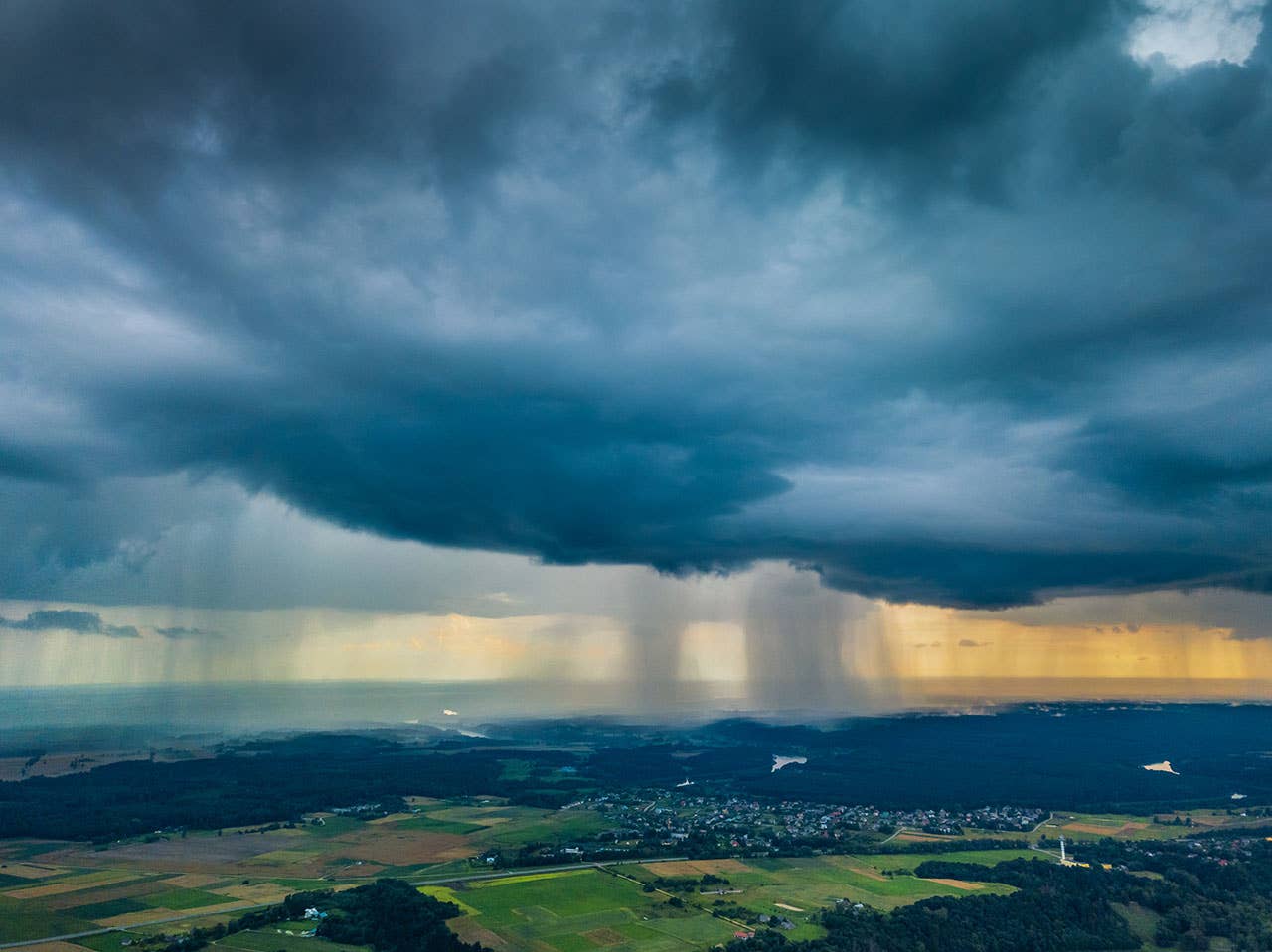
While many of our trips remain within 100 miles of our home airport, long-distance travel in general aviation aircraft is where our beautiful little aircraft really shine. Looking down on those miserable souls stuck in traffic, as we cross an entire city in minutes, might be one of our greatest joys! However, if an outing is poorly planned, the many moods of the weather can turn a two-day trip into a frustrating weeklong nightmare. Thankfully, there are some planning techniques, handed down from our elders, that may help.
One of the luxuries of military aviation was the opportunity to be briefed by a bright young meteorology officer or NCO before every mission. Slowly, through osmosis, pilots absorbed the science of the atmosphere from these professionals. They took the long view of weather systems and thus could help us see beyond the eight- to 10-hour window we were interested in. Every conversation with these gifted young folks made us wiser!
On the civilian side, the zenith of the Flight Service system in the late 1960s boasted 297 individual Flight Service Stations scattered across the country. Once again, pilots regularly stood toe to toe with a specialist across the desk and learned not just about the forecast for the day but the longer weather patterns that might impact their entire trip. And these regional weather experts understood the peculiarities of the weather at their many and varied locations in a way that a more distant observer might not. Each of these face-to-face conversations contributed to a pilot's weather education, experience and, once again, wisdom.
Today's centralized Flight Service professionals do an admirable job, but they are reaching a steadily decreasing portion of the pilot population. The transition to completely online weather information is relentless. The good news is modern pilots have immediate access to an avalanche of weather information on their glass-panel avionics, portable devices and smartphones that pilots of even a decade ago would envy. However, more than ever, the pilot is on their own to decipher what is important and what the immediate and long-term weather future may hold. Thankfully, the government and commercial weather providers have taken great care to ensure that pilots have the appropriate briefings and hazardous weather information available as they electronically file and fly.
This rapid transition to a self-briefing pilot recently led the Federal Aviation Administration (FAA) to publish an Advisory Circular (AC) focused on helping pilots navigate weather self-briefings. AC 91-92, "Pilot's Guide to a Preflight Briefing," takes a step-by-step approach to the many weather sources, data and displays. It provides a basic framework for pilots to follow as they wade through all the available data. The most valuable part of the document is series of checklists designed to produce consistent short- and long-term weather analysis. The FAA puts it this way: "Developing self-briefing skills helps to identify areas that require closer investigation." So where might a thinking pilot begin?
Start by reviewing the trusty Prog Chart about a week before departure. The Surface Prog (Prognostication) Chart is simply a graphical representation of the complex worldwide weather model. It identifies where the highs, lows and fronts are and are forecast to be for the next week or so. The High-Level Prog Chart maps the steering currents, which guide the weather systems, which help us complete our pattern analysis. Taken together, these charts allow for some strategic thinking starting days before a trip is scheduled.
For example, traveling eastbound across the USA at a blinding 2 miles a minute often consists of chasing a series of cold fronts. Fly up to the backside of the eastbound cold front, land and stay overnight while it moves east, then repeat. Westbound aviators end up flying right up to the frontal boundary, tying down securely for the night, then off to a hotel for an evening of rest, nourishment, thunderstorms and high winds. Once the weather clears, jump back in the airplane and enjoy the cooler and gustier air behind the front.
All fronts are not created equal. Comparing the surface prog to the daily composite radar images days ahead of departure can help pilots size up the relative strength of the frontal system. Frontal boundaries, combined with moisture content, temperature and a variety of other factors, create wildly different frontal strengths and movement. Studying these patterns days ahead of time, like the meteorologists and FSS briefers do, can help a thinking pilot understand the weather rather than simply knowing the forecast for the day of flight. Using this information to plan strategically by leaving a day earlier or a day later may reduce the total length of the journey by several days. Now, once the plan comes together, what else might a thinking pilot do?
What would Jimmy Buffett do? In case you were not aware, "Margaritaville" singer Jimmy Buffett is an accomplished pilot as well as the "son of the son of a sailor." Now, sailors obtain their propulsion solely from the wind and spend their lives looking for fair winds and following seas. With the notable exception of seaplane pilots, who are the wizards of the water, we don't have to worry much about H2O on the surface. However, we set sail upon an ocean of air that has many strong currents. For example, a sailor might remind us that the shortest distance between two points is not always a straight line. With the advent of GPS, many of us have become "children of the magenta" line and may assume GPS direct is always the best path. However, for a multi-leg trip, the prog chart and graphical winds aloft charts can help pilots keep the wind at our back, the rain off the cowling, and the clouds out of the windshield. For eastbound travelers, a deviation of less than 100 miles to the south of a low-pressure center, or north of a high, may turn a potential headwind into a crosswind and avoid the worst of the weather. Go west and reverse the calculation. And, of course, the winds usually are stronger as you climb.
"The superior pilot uses their superior judgment to avoid situations requiring their superior skills." ---Anonymous
If Will Shakespeare had been a pilot, he might have said, "to climb or not to climb, that is the question." Often, we agonize on this decision. Does it cost more fuel to climb another 2,000 feet and pick up that additional 10 knots groundspeed? This is a significant issue for large, thirsty jumbo jets like the 747 that utilize "step climb procedures." These planned increases allow them to climb to more efficient altitudes as they burn off fuel and reduce gross weight. However, a review of the typical GA POH climb charts reveals that a full-power climb, even at our max gross takeoff weight, yields no more than a 40% fuel penalty. And that increased fuel burn is only for the brief time required to climb into more favorable winds. By sampling specific stations on your route, the winds aloft data on your navigation app turns out to be incredibly useful. It can help you plan for the best altitude before the flight, and, equally important, adjust it en route. And the sooner the change is made, the better.
Consider the impact of the geography and terrain on the weather. Nearly all long trips require at least one mountain range crossing. Whether it is the Rockies, the Bitterroots or the Appalachians, rising terrain changes the nature of the weather model. In the west, it is not uncommon to see 40 knots of wind at 10,000 feet. However, crossing Tehachapi Pass or Big Bear in Southern California under these conditions can result in a dramatic unplanned climb or worse descent. Mountain wave is the real deal, and it has caught more than a few pilots by surprise. Arguably the most famous of these encounters occurred in 1964, when a heavily instrumented B-52H Stratofortress was sent out looking for Mountain Wave turbulence, and it found it. The encounter removed 90% of the vertical stabilizer, and the entire rudder, from the aircraft. The aircraft and crew landed safely but only by dint of some expert airmanship, including extending the rear main landing gear for use as a drag rudder! Brilliant.
So, flying in the mountains when the winds are strong deserves some special precautions. Route planning should provide the most clearance between the aircraft and the ridgelines, even if it means flying a bit out of the way. Remember when your CFI reminded you to cross ridgelines at a 45° angle? Well, it works! All these techniques give the pilot a way out because you can't outclimb mother nature.
Flying around the Great Lakes can unexpectedly introduce pilots to "lake effect" precipitation, usually snow. Now, long ago, most aviators suspected that lake effect was just an excuse for a busted forecast, but as we became older and wiser, most understood the truth. Combine warmer moist lake air with colder air pushed by light winds, and suddenly snow showers appear downwind. Around the Great Lakes, lake effect can linger for days, weeks and occasionally months.
Then there is Tule fog, named after the wet "Tule Grasslands" in the San Joaquin Valley. It is an insidious hazard. The morning may start out with zero-zero visibility, and then the early-morning fog may dissipate. However, the sun's rays can hit the wet grass and, bingo, you are back to zero-zero conditions in minutes. In the winter, the San Joaquin is only open for VFR business between late morning and early evening.
East and West Coast advection fog is great for vineyards but not so much for making your scheduled arrival time. All these are areas where local specialists used to share their valuable experience. Now the pilot bears the lion's share of the responsibility. This is one of those "areas that require closer investigation" that the FAA is concerned about. The good news is that the weather today is easier to decipher.
Plain text weather is here to stay! Can I get an amen? Many of us cut our teeth on encoded weather observations and forecasts full of numbers, squiggles and symbols. And just like morse code, this encoded weather information communicated effectively, to a point. However, both Morse Code and encoded weather were a response to a problem that was solved long ago. The bandwidth limitations of early systems---in the case of Morse, a single bandwidth---caused data to have to be encoded, transmitted and decoded repeatedly. Blessedly, we are free of these limitations, and frankly plain English communicates much more effectively than a series of memorized patterns, numbers, lines and symbols. And, of course, the wide variety of graphic weather products available is staggering. The trick is to organize these in an efficient manner, so that, as the FAA puts it, "areas that require closer investigation" stand apart from the clutter.
"If Will Shakespeare had been a pilot, he might have said, ’to climb or not to climb, that is the question.' Often, we agonize on this decision."
Use all the data available in your own cockpit. Once airborne, the modern general aviation pilot is light years ahead of their brethren from the "not-so-good old days." Where once a weather update might require several staticky radio calls and scrawled notes, now the global weather picture is at your fingertips. If you have the right level of service, whether it is ADS-B, Sirius or cell-based, updated weather is a godsend. The trick is to use it strategically.
For example, the cruise leg of the first flight of the day is a great time to update the weather for the remaining legs that day. This is truly staying ahead of the airplane. Are ceilings, visibilities and winds still as forecast, or do we need to plan for an overnight stop after the next leg? Better to make arrangements early to avoid the pressure of a late decision, closed FBO, no fuel and zero ground transportation as darkness approaches and the weather closes in.
And remember that every bit of the weather you read or see on the iPad has some sort of time delay built into it. The radar display is the most obvious offender. Attempting to use the composite radar display on an iPad to navigate close to an area of thunderstorms can be hazardous to your health. There is a reason that airliners have actual airborne radar equipment, and even then, it has serious limitations. In fact, just don't mess with thunderstorms. Convective thunderstorms are big, and Cessnas and Pipers are small. The odds are stacked against us.
Finally, always have an out! Back in the day, those face-to-face briefings from the meteorology officer or the regional FSS specialists were very good at schooling pilots on possible escape plans. Where can you go when the ceilings begin to get lower than forecast, the rain harder and the visibility reduced? Is there an area of CAVU nearby? What is the terrain like, the local peculiarities, and how might these impact the weather? In the end, can the pilot make the famous 180-degree turn back into clear weather? And, of course, the ultimate way out is a credit card, courtesy car and motel room! As they say, tomorrow is another day.
The good news is that we have the most complete and current weather information available to us that we have ever had. In fact, we may just have too much from time to time. How we use that data will determine our level of success or failure. The FAA, commercial weather providers, and Flight Service all work to help pilots organize the available data more effectively.
Especially when we make that long cross country, on business, to see the family, or maybe that annual pilgrimage to Oshkosh, there are some rules of the road. Getting to know the big picture before you get into the details is a great first step. Take the time to become a student of the atmosphere. Dig out the trusty prog charts a week ahead of time and decipher what they have in store for your flight. Where are the frontal systems, and how strong are they? Channel your inner sailor and decide if the magenta line is really your best friend. Are there regional weather patterns or unique terrain that will impact your decision-making? Should you go high or go low? And, of course, always have a way out if the weather does not cooperate. No big surprise here, good decisions made early in the day are usually better than poor ones made later! Remember, "the superior pilot uses their superior judgment to avoid situations requiring their superior skills." Safe travels.
Subscribe to Our Newsletter
Get the latest Plane & Pilot Magazine stories delivered directly to your inbox

