CC Log: Flying Africa In The Midst Of Turmoil
The geography was challenging; the political landscape, even more so.
cc log: flying africa in the midst of turmoil
If you've never been to Africa, you may be surprised, as I was, to learn that the continent is actually a huge horizontal band of semi-impenetrable jungle enclosed on top and bottom by twin strips of the world's most forbidding deserts.
I should have known, but I guess I never realized the scope of the Sahara on top and the Kalahari/Namib on the bottom. It was 1984, and a quartet of mostly dissimilar airplanes was being ferried from the U.S. to South Africa, mine to Johannesburg, one to Durban and two to Cape Town.
It had been a long trip in relatively good weather, and we were happy to have made it to Libreville, Gabon, with no mechanical glitches. I was flying the largest airplane of the four, a Cessna Crusader twin, destined for Rand Airport in Jo'burg. There was also a Piper Seneca, an Arrow and a Mooney 231.
We'd flown to St. John's, Newfoundland, Canada, then diagonally 2,000 nm across the Atlantic to Funchal in the Madeira Islands off the coast of Morocco (yes, the home of Madeira wine).
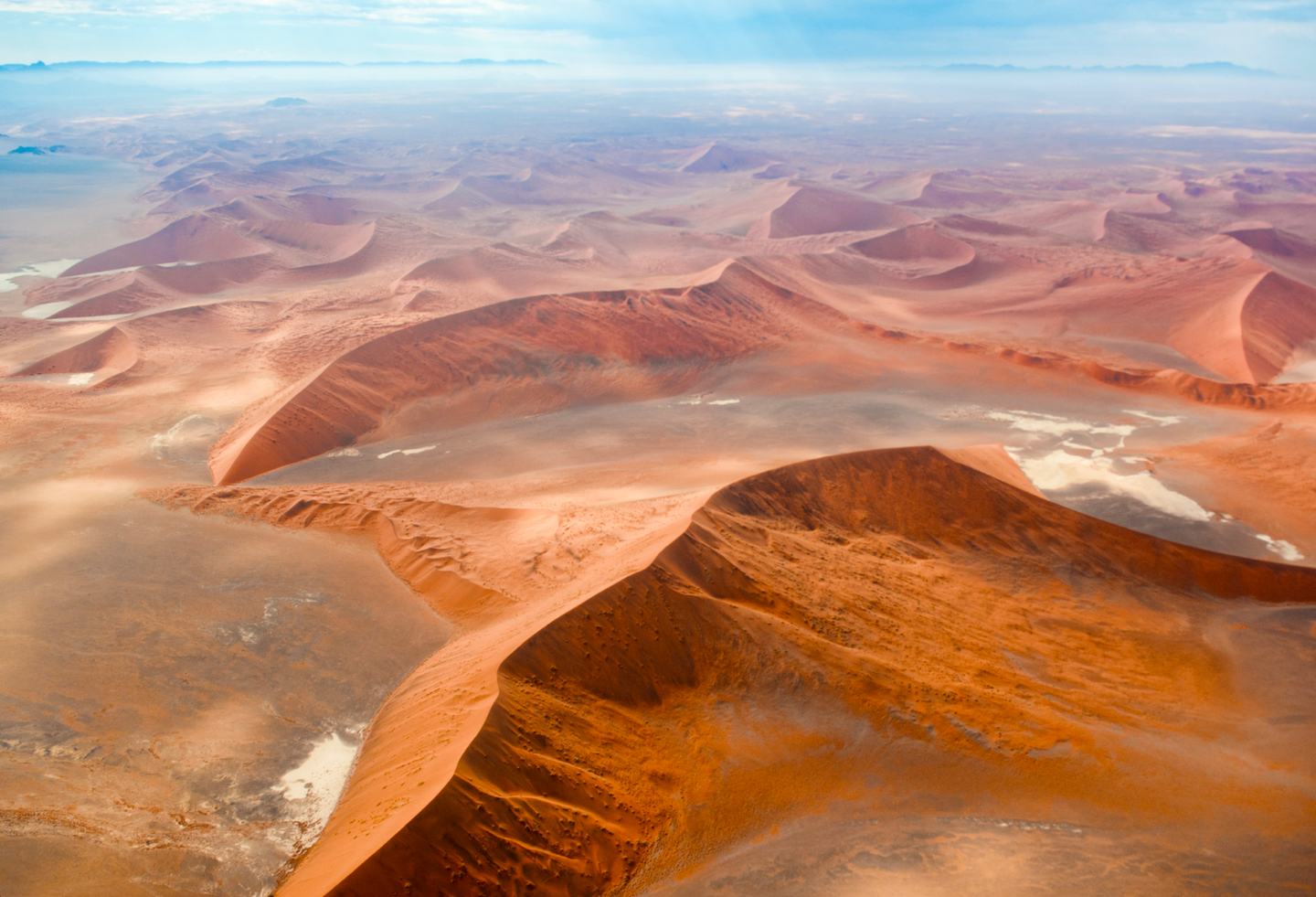
For me, the assault on the world's largest desert seemed almost incomprehensible. The Sahara is roughly the size of the entire United States (excluding Alaska), a little over 2,000 miles across by 1,500 miles tall. Looking down on the expanse of sand and rock, mountains and dry lakes, it seemed almost incomprehensible that anyone could live there, but nomadic tribes of Tuaregs and Bedouins have somehow managed to find water and subsist despite 120-degree heat in summer and terrain that is totally resistant to any attempts at farming. It's Death Valley times 1,000.
Fortunately for us, we don't need to fly the entire expanse of the Sahara. Our route took us across 1,700 miles of Mauritania, Mali and Ivory Coast to keep us clear of countries in conflict, which was common at that time. At our cruising altitude of 11,000 feet, their weapons could probably have reached us.
"The ’itch' is where weather systems from the northern and southern hemispheres converge and sometimes create hellacious thunderstorms."
As I looked back at the aft cabin, I saw life vests, a four-man raft and cold-water dry suit, all protection against going down in the ocean. But there was nothing there to protect us from the heat of the desert.
In fact, we all know there's unlikely to be any search and rescue of any kind in the Sahara unless someone in the U.S. military hears about an American crash in the desert. The countries we overfly have a hard time funding food and support for their own people, never mind spending money looking for wayward Americans. If we have any emergency in the desert, we better hope we can solve our survival problems ourselves, as it's unlikely anyone will come looking for us.
On our first African desert hop, we crossed near the village often named as the end of the Earth---Timbuktu, Mali, is desolate and nearly uninhabited, no matter how you spell it. As we passed Bamako, Mali, the Earth began to fade back through tan toward light green, a region known as the Sahel, and worthy of its name. The blistering Sahara fell behind and Yamoussoukro, Ivory Coast, unrolled beneath our wings. We finally saw the Gulf of Guinea and our next overnight stop, Abidjan, Ivory Coast (or CoÌte d'Ivoire, in the French translation).
As we approached the sometimes dangerous Intertropical Convergence Zone (sometimes standardized as simply the ITCZ, pronounced "itch"), we're especially cautious about the weather. The "itch" is where weather systems from the northern and southern hemispheres converge and sometimes create hellacious thunderstorms.
The terrain below turns from tan/brown to hard green where the jungle becomes an unforgiving mass of intertwined trees that offer very few places for an emergency landing without totally destroying the airplane and everything in it.
The Mooney's pilot lifted our spirits a little by commenting that there was a Club Med down the coast a few miles. (No, we didn't stay there.)
From Abidjan, it was only a short 900 miles across the Western Notch of Africa to Libreville, Gabon, practically right on the equator. Libreville was a popular stop in those days because several American oil companies had major investments in exploration cites, so Americans received big discounts.
Flying south down the West African coast was a lot less comfortable. Now, we were starting to leave the dense African double-canopy rain forest behind as the land below began to transition back toward the desert. Angola was only a few hundred miles south of Gabon, and anyone who had to land there was automatically in deep trouble. Angola was heavily subsidized by Russia, and the best advice if you needed to stop there was "don't." It would be better to ditch in the ocean than land in Angola.
As a result, we nearly always diverted due east to an imaginary waypoint 20-30 miles back out over the Atlantic just in case some trigger-happy soldier with a surface-to-air missile decided to shoot at us. We'd also climb as high as possible for the same reason.
As we traveled south, the weather began to turn back from jungle clouds and turbulence to desert clear, and we had a good view of Angola's capital city, Luanda, far to our left. Whenever the performance of our airplanes was compatible on a multiple-aircraft delivery, we tried to stay together, just in case someone had a problem. Fortunately, that was a rare occurrence. (Once on a seven-Cherokee delivery from Florida to Amman, Jordan, I was flying the lead trio of airplanes, and we'd departed from Heraklion, Crete, and were vectored directly across the city of Cairo, Egypt. I knew that had to be a mistake, as I'd made several trips to Jordan, and we'd always been routed to the south over Luxor before being allowed to turn north up the Gulf of Aqaba to Amman.)
Sure enough, not everyone had received the memo. We passed over the pyramids, looked down and saw a pair of Mirage 2000 fighters departing an Egyptian Air Base. Thirty seconds later, they went drifting by as slow as they could, and the leader inquired, "Who are you, and why are you flying toward Cairo?" I doubt he thought we were part of an Israeli invasion force.
I explained things to the fighter pilot and read him our clearance number, and he came back, angrily, and said, "I don't care about your clearance numbers. Make an immediate 90-degree right turn and fly direct to Luxor." We did as instructed, and the two fighters escorted us south for a few miles before finally breaking off and heading back to their base. As they screamed away from us, I felt obliged to advise him that there were four more airplanes several miles behind us. He answered with an expletive deleted.
Flying in loose formation was technically against the rules as we all filed IFR, but no one in Africa seemed to care as there was hardly any ATC to deal with. We almost never saw another airplane in flight, and almost no one came up on the radio if we called to make position reports or ask about weather ahead.
(In Djibouti, East Africa, I once asked the briefer in the weather office about weather in Nairobi, and he handed me a two-day-old satellite photo of the entire continent. Not much detail to that.)
One of our pilots had firsthand experience in Angola following an engine problem a year earlier in a Cessna 206. He made a landing on the beach in Angola near Luanda and was promptly accused of being an American spy. He was imprisoned in Luanda and finally released eight months later when the U.S. traded a Russian spy for him. He'd lost 50 pounds in the Angolan prison.
We flew south about 700 miles, passing Yuri Gagarin Airport, just to remind us of who pulled the strings in Angola, and watched Africa turn back to pure desert once more.
Finally, we saw the Cunene River that emptied into the Atlantic. When we passed the river, we knew we were back in friendly airspace and could turn left over Namibia.
"We almost never saw another airplane in flight, and almost no one came up on the radio if we called to make position reports or ask about weather ahead."
Once again, we were back over the desert, in this case, the Kalahari. The infamous African jungle was far behind us, and, for me, my destination of Johannesburg was only 700 nm across the bottom third of South Africa.
We landed at Windhoek, Namibia, where most other pilots weren't familiar with the new Cessna twin or its competition, for that matter. Its airstair door and big cabin were more reminiscent of a corporate turboprop than the Piper Seneca it was actually designed to compete with.
The following day, the Mooney pilot and I filed flight plans for Gaborone, Botswana, slightly west of the border with South Africa.
Remember, this was 1984, and we couldn't file directly to any destination in South Africa. South Africa still had apartheid policies in effect, and none of its neighbors would have approved a flight directly to South Africa. As a result, we filed for Gaborone (which had substantial business and trade agreements with South Africa), and ATC looked the other way. When entering Botswana airspace, we immediately changed our destination to Johannesburg.
On the ground at Rand Airport in Jo'burg, I discovered there was a major celebration planned for the arrival of the first Cessna Crusader to be delivered overseas, in this case, halfway around the world.

Subscribe to Our Newsletter
Get the latest Plane & Pilot Magazine stories delivered directly to your inbox

