CC Log: Flying The Islands Of Hawaii
Hawaii is sometimes regarded as a forgotten destination, but not by anyone who has spent much time there. Especially pilots.
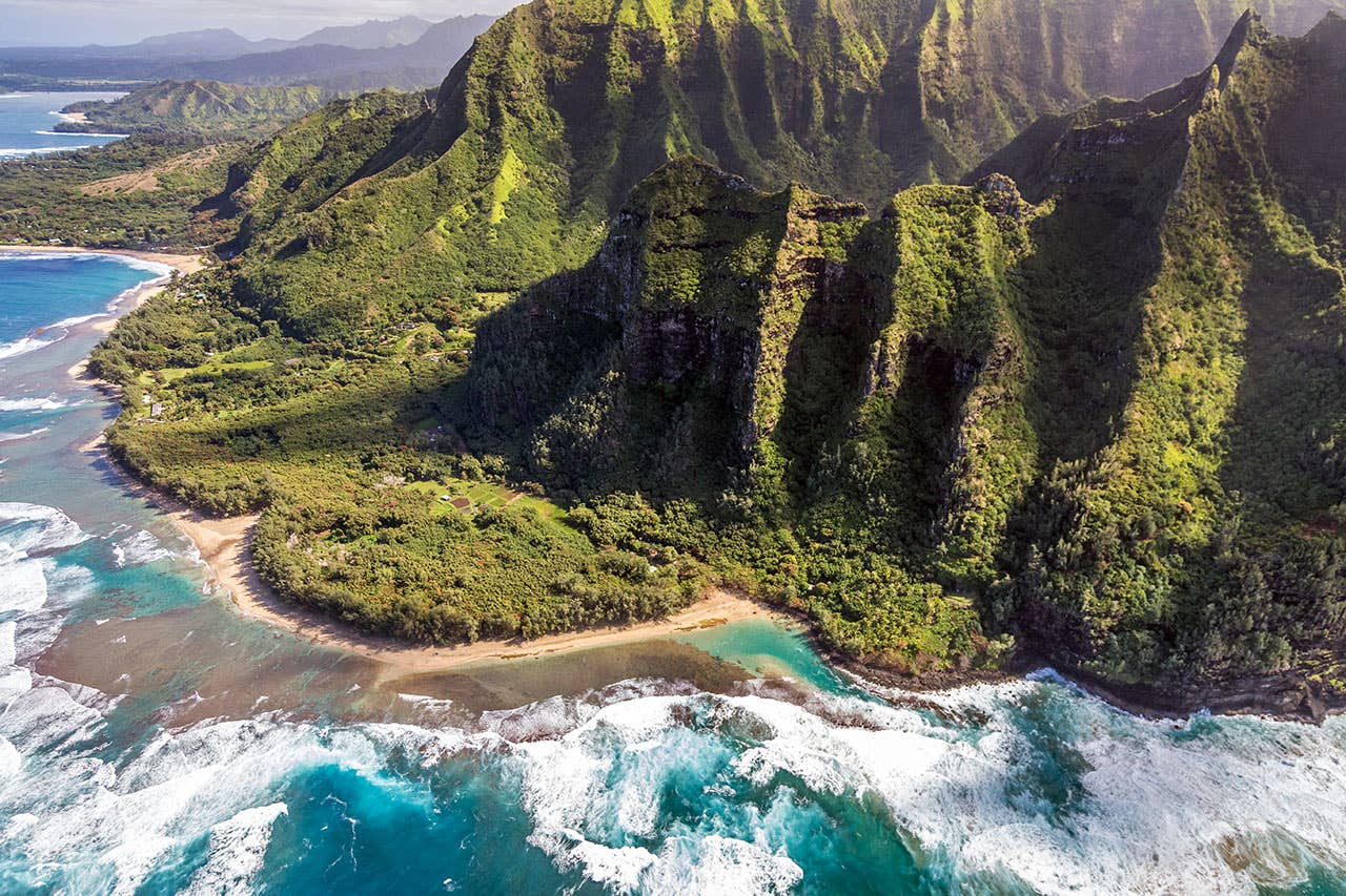
Kee Beach, Kauai, Hawaii
If you're departing Santa Barbara for Honolulu or other places in Hawaii, your initial heading is 230° to 240°. That's not too hard to do if you're using runway 25 at KSBA, and you'll most often be flying into a headwind that will slowly begin to shift to the right, and your course will gradually turn more and more westerly. ATC will grudgingly put up with 6,000 or 8,000 feet if that's all you have to offer, but they'd be happier with 10,000 feet if you manage it.
The Channel Islands, just off your left wingtip, will fall behind in a few minutes, and you'll need to face the hard reality that those islands of sand and stone will be the last land you'll see for 2,000 nm and 13 to 14 hours. Mainland California to the Hawaiian Islands is one of the longest legs anyone flies. About 97% of the Earth's water is contained by oceans, and you're about to take on one of the longest legs in the biggest, deepest of them all. Just hope you'll never find out firsthand about depth.
Pilots use established checkpoints on the Great Circle route to PHNL, or you can set up your own flight log. San Francisco control doesn't really care, especially on the low-level flights of most piston aircraft. While traffic at high altitude between the mainland U.S. and Hawaii is often extremely busy, there aren't nearly as many low-level aircraft flying in the airspace below 18,000 feet.
After the first hour of your Pacific crossing, your job becomes easier, more one of monitoring your fuel burn between wing tanks and ferry tanks, keeping track of the wind and looking down at the unrolling of thousands of miles of ocean.
Every once in a while, you may look down at a ship sailing west at perhaps 15-20 knots. Shipboard passengers below may be more comfortable in the luxury of their own private poop deck, but you may be on the ground at Honolulu in a matter of a few hours rather than a few days.
You'll also notice that your speed is benefitting from some push from the wind, and your course is becoming progressively more southerly.
If the weather and winds are typical and you're flying above 10,000 feet, the peaks of the Big Island's two major dormant volcanoes, Mauna Loa and Mauna Kea, will stick up out of the clouds slightly to the left of course. These classical volcanos reach to nearly 14,000 feet, and they're welcome signposts that your trip is nearly over. Even without a turbo under the cowl, you probably will have climbed to 12,000 feet or more when you're 100 miles out.
One of the joys of approaching Hawaii in a private aircraft is that you actually get to see it as you gain on land after half a day of sitting in the left seat. The islands live up to their brochures, splashes of green as opposed to the blue ocean. Fly your Ovation or Skylane or Aerostar to the islands, and there are windows in practically every direction.
Perhaps ironically, one of the first things you'll notice as you go feet dry above the north coast of Molokai is the small village of Kalaupapa, a leper colony that's now pretty much abandoned.
The standard arrival corridor brings you across Molokai to be vectored back out to sea, even if you feel you've had enough of that for one day. When the approach path is clear for Honolulu's huge runways, you'll be turned back in on a straight-in or a semi-circular approach.
Like a primarily international airport that deals with hundreds of flights to far-off destinations every day, PHNL manages mostly long-distance, heavy jet traffic, but the controllers still do an excellent job of fitting relatively slow general aviation aircraft into the flow of long-haul Boeing and Airbus jets bound for destinations all over the world.
Thirty-five years ago, I did a video for the ABC TV program Wide World of Flying on the joys of touring Hawaii by air. We visited every island except the Big Island, where a week of near-constant rain and thunderstorms made it impractical to continue taping. That video wasn't associated with a ferry flight, but I've been fortunate to visit Hawaii several dozen times in conjunction with delivery flights. I've taken lots of welcome days off after 12 to 17 hours in the saddle, and Hawaii has become a welcome first stop on the high road to Australia and Southeast Asia.
Despite the need for ferry tanks to get to Hawaii, you won't need them once you're there. Hawaii consists of a half-dozen islands and roughly a dozen airports, not all of which are attended. The distance between islands varies from 30 miles between Maui and Lanai, the latter purchased by Oracle billionaire Larry Ellison in 2012 for $300 million---yes, the whole island---to about 90 miles between Oahu and Kauai at the far northwest corner of the state. You could fly a complete round trip from the Big Island to the tip of Kauai in many general aviation singles on one tank of 100LL.
The Big Island is exactly that, even bigger than most people know. The giant edifice of primarily eruptive material has been building for thousands of years. As mentioned above, Mauna Loa and Mauna Kea are both giants that top slightly below 14,000 feet msl, but msl doesn't adequately define these mountains. They also extend far beneath sea level. In fact, Mauna Kea is the tallest mountain in the world if measured from its base. Its height is actually 33,500 feet, well over a half-mile taller than Mt. Everest. To do the math for you, the mountain plunges about 20,000 feet below the Pacific.
The third volcano on the Big Island is Kilauea, active but no longer erupting since 2018. Hilo, technically the closest airport to California, is 20 miles from the much-publicized lava flows of Kilauea.
As if to avoid being overshadowed by the Big Island's tall topography, Maui has its own dormant volcano, named Haleakala, replete with cold lava fields running down the ocean. Back in the 1960s, NASA discovered that the mountain looked similar to the irregular geology of the moon and began training astronauts in preparation for the coming Apollo landings. The space agency also initiated development of the moon buggies that would be used on the later Apollo missions to transport crewmembers around the landing site.
Maui is also one of the most popular tourist destinations, with many first-class luxury resorts facing across the channel between Maui and Lanai. Bring money if you visit.
As many pilots may know, Kahului Airport on Maui, the next commercial airport in the Hawaiian chain, was the site of a nearly miraculous emergency landing by an Aloha Airlines 737. The Boeing literally came apart in flight over Maui, losing a major portion of its top/forward fuselage in April 1988. The flight crew somehow managed to guide the airplane into Kahului and avoid further damage. The accident investigation revealed that the airplane, though properly maintained, was Aloha's oldest 737 and had been used almost exclusively in short-haul flights between islands. Corrosion was cited as another contributing factor in the fuselage disintegration.
Maui is also the island where aviation pioneer Charles Lindbergh lived his final years in obscurity. The small airport at Hana on Maui's north coast is about 15 miles from the site of Lindbergh's grave.
Molokai is perhaps the least heavily populated of the Hawaiian Islands, but it has a magnificent North Coast with tall cliffs rising straight out of the ocean and climbing almost vertically to the hills above.
Kauai is the most remote of the Hawaiian Islands, located 90 miles northwest of Oahu. Many visitors regard Kauai as the most dynamic island in the Pacific. Again, pilots, with the benefit of the high station, get to see virtually all of Kauai as opposed to being confined to a bus or a turbine helicopter. They have the best view there of such geology as Waimea Canyon, often referred to as the Grand Canyon of Hawaii. In fact, Waimea is a scaled-down version of Arizona's full-sized version, but the Hawaiian edition benefits from rainfall that Arizona could only dream about.
Steep cliffs and vividly green mountains make the island a wildly photographic subject. Kauai deserves an entire book on where to go and what to see, so we'll leave that to the Hawaiian Chamber of Commerce.
No, we didn't forget the most populated island in Hawaii, Oahu, home to the state capital, Honolulu. Oahu provides a magnificent collection of all the best that makes up the Hawaiian Islands, and pilots in their own or rental aircraft have by far the best view of the ultimate Pacific Island state.
Several years ago, I had perhaps the ultimate trip of all time in Hawaii. A client without a pilot's license purchased a Cessna Turbo Stationair and hired me to pick it up in Wichita and fly it to Hawaii. He had a pilot scheduled to fly him around the island, but that guy got sick, and the owner wanted to get into the sky immediately. He asked if I'd stay an extra day and give him and his family a tour of all six islands.
We departed Honolulu and spent a full day circumnavigating the entire chain of islands. Though I've flown to and around Hawaii many times before and since, that comprehensive flight above the islands of paradise was by far the best mini-tour I've ever made.
Most of the time, I really love this job.

Subscribe to Our Newsletter
Get the latest Plane & Pilot Magazine stories delivered directly to your inbox

