Weather Avoidance: Back To Basics
Ten simple steps to enhance your weather planning and avoid Mother Nature’s worst
 |
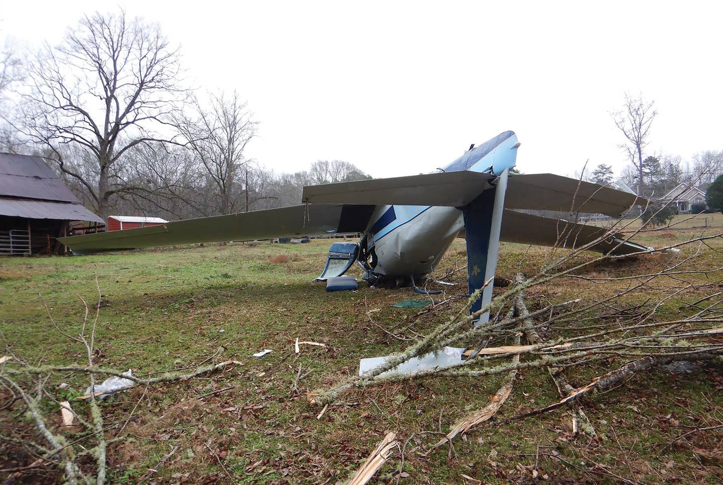
It's one of the great paradoxes in aviation that one of the biggest killers of pilots ---weather---is one of the least understood and least taught subjects in primary flight instruction. According to the latest NTSB statistics, weather remains one of the top five accident causes in general aviation, with an 85% fatality rate. Yet, the weather knowledge required to successfully pass the FAA's written and practical tests is marginal at best. With that in mind, how we do learn to avoid the worst Mother Nature can throw at us?
First, we have to accept the fact that most of us will never become expert meteorologists. Thanks to advances in technology, we only need to understand weather enough. There's a great tradition in aviation where the truly complex stuff was left to the real weather experts---the meteorologists who sat at the local flight service station office---and looked out the window. Today, the responsibility has shifted to the pilot more than ever. Technology presents the information, but we must know enough about it to make the right go/no-go decision.
To help us delve into this complex subject, we spoke with Scott Dennstaedt, a pilot and recognized weather expert. Dennstaedt spent several years as a National Weather Service (NWS) meteorologist, earned an M.S. degree in meteorology and computer science, and today spends his time as a CFI in technically advanced aircraft (TAA) teaching pilots about weather. His website, www.avwxworkshops.com , is a treasure trove of weather information, tips and technical videos.
"The fundamental problem," says Dennstaedt, "is that as pilots, we have to master a lot of disciplines, and we do it by practicing skills. But the FAA's current curriculum doesn't allow us to practice weather skills. What little knowledge is on the exams is not representative of really understanding weather."
I asked Dennstaedt what we can do as pilots to better understand weather, and how to avoid the really nasty stuff that could kill us. The answer is surprisingly simple, and involves better understanding of the resources we already have, along with using technology to put it all together.
Old Dog, New Tricks
One of the best techniques to avoid getting into weather trouble is learning how to use traditional aviation resources. The Flight Service briefing is still the most popular way pilots get weather information, and is usually the first step in getting a complete weather picture. But learning what this briefing can't do is an important part of learning what it can do.
"I don't believe that a flight service briefing can keep you safe on its own," says Dennstaedt. "It's useful when the weather's really good, or when it's really bad. But it's the middle where the briefing falls short."
 NTSB statistics show weather as one of the top five accident causes in general aviation, with an 85% fatality rate. |
One example is the phrase, "VFR not recommended." FAA research has shown the phrase is offered much too often. The net effect is that many pilots have heard the warning, decided to launch anyway to "take a look," and have found no bad weather along their route, confirming their confidence. So the phrase has lost some of its bite. But experts caution it's still a phrase that should sound an alert to pilots, to prod them to gather more information before making a decision.
It's up to the pilot to interpret the information received in a briefing. For example, many pilots abuse the terminal area forecast (TAF). Dennstaedt explains that most pilots don't realize a TAF is only good for a five-mile radius around the station. "It's a point forecast, and not indicative of the weather along a route," he adds. Pilots get into trouble reading the TAF and mentally expanding its forecast farther out than it should be.
Another part of the standard briefing pilots need to rethink is the winds-aloft forecast (also called "FB winds"). The problem is the report's "resolution," which pilots can think of as "freshness date and accuracy." Winds-aloft forecasts are good for six hours; which is too long in many instances. Also, the readings are taken at the closest grid point to the reporting stations, which are 12 kilometers apart, and they're given at 3,000-foot intervals. "A lot can happen in between those 3,000-foot layers," says Dennstaedt. "Use winds-aloft forecasts in conjunction with other tools to tell the whole story."
Strategic Plan, Tactical Decisions
Weather avoidance is a strategic exercise that consists of acquiring data and making tactical decisions based on that data. Because weather isn't static, a one-time telephone briefing---with its shortcomings---isn't always adequate for making decisions that will affect your and your passengers' lives. Pilots can supplement their current techniques with a multi-step approach to weather planning and avoidance.
1 Spot Trends: Seeing what the weather has been doing in the past several hours is something few pilots do, but is the best indicator of what it probably will do. One tool for this is the surface analysis chart. "One of the best tips I can give pilots is to learn to read a surface analysis chart," says Dennstaedt. The surface analysis is a computer-generated report that's transmitted every three hours and covers the contiguous 48 states and adjacent areas. It shows the areas of high and low pressure, fronts, temperatures, dew points, wind directions and speeds, local weather, and visual obstructions. The chart also shows weather at specific reporting points across the country--- each depicted by a "station model" with lots of useful information. Charts are available for previous days.
2 Gather Data: The Internet and cable/satellite television have made weather data gathering a no-brainer. But the overwhelming amount of weather data available has made it confusing for pilots to find what's truly useful.
Pilots should use many sources combined to get the most accurate picture of the weather. For example, the lay person's "Weather Channel" has useful, aviation-specific weather available at www.weather.com by drilling down to "aviation." Even their televised weather is a great place to start. Though not technically FAA approved, they provide compact, packaged summaries to get you started. The National Weather Service's Aviation Weather Center (www.aviationweather.gov) is useful, especially their AIRMET and SIGMET watch boxes.
Aviation Digital Data Services (ADDS) may be the best aviation weather site on the Internet. They have vast amounts of information, a ton of useful reports and graphics for pilots, and so much more that you could devote an entire article to the site. One highlight is their new "Flight Path" JAVA tool that depicts information about weather along your route. It's free at www.aviationweather.gov/adds.
3 See The Big Picture: Print out a copy of the FSS briefing. The purpose of printing a standard briefing from DUATS (www.duats.com) is because it's difficult to absorb all the information by telephone alone; it's easy to miss something. It should be noted that both DUAT and DUATS are provided by the FAA, but each is slightly different in the way it presents information. DUATS recently updated their website to include new features. Either site will provide a textual briefing you can print and review.
| L-3 AVIONICS STORMSCOPE | |
| L-3 Avionics System's Stormscope hit the 60,000th-unit-manufactured mark just last year. The weather-mapping system has become something of an industry standard since its introduction to general aviation in 1976. For pilots who want real-time lightning and thunderstorm information, nothing beats the up-to-the-minute Stormscope display.
The Stormscope is what's known as a "spheric" device. It detects lightning activity in real time by analyzing the radiated signals of electrical discharges from storm cells. Stormscope, by detecting the electrical activity present as the storm builds, can provide an accurate view of areas that should be avoided. The unit processes both azimuth and range data to determine the location and intensity of dangerous thunderstorm cells---presenting the findings in real time. Because lightning signifies the beginning and most dangerous phase of a thunderstorm (including severe turbulence and up and down drafts that could break up an aircraft), detecting it in real time is critical. Only a spheric detector can map all the stages of a thunderstorm, allowing pilots to avoid areas that would be hazardous to the aircraft. Traditionally, lightning information has been available in the cockpit from ground-based detection equipment through data-link subscriptions, usually packaged with other products such as NEXRAD and METARS. The problem is the data is usually at least a few minutes old, sometimes more. And while data link provides many useful tools for the pilot, its NEXRAD imagery shows only precipitation---which doesn't always signify a thunderstorm. Stormscope can detect where storms are building, and will show lightning before NEXRAD shows precipitation. Stormscope displays lightning in 25, 50, 100 and 200 nm ranges, and is designed so it can interface with most modern MFDs. It also can be set up as a dedicated display or overlaid on moving-map displays on popular glass cockpit systems like Garmin, Aspen, Avidyne and many others. The Stormscope processor updates the MFD every two seconds, and each strike remains on the display for approximately 3 minutes, depending on the frequency of strikes.
Stormscope comes in three variants. The WX-500 is designed to interface with MFDs, while the WX-950 is an "always-on" dedicated display. The WX-1000 interfaces with L-3s "Skywatch" traffic advisory system and can be configured to display on an EFIS or radar indicator. It also comes with added features like programmable checklists, selectable ranges and views, and a timer for approaches. The capabilities of the Stormscope system are impressive and useful. Pilots can turn the unit on while on the ground and scan lightning activity up to 200 nm ahead to help make go/no-go decisions. When the unit is used in combination with data-link products such as NEXRAD, it becomes an essential tool for keeping flights away from the nasty convective stuff. As over 60,000 pilots have discovered, Stormscope---for under $6,000---is an excellent addition to any cockpit. Visit www.l-3avionics.com. |
|
4Standard Briefing: Even with its limitations, the standard FSS briefing is useful, especially for getting the latest information. Knowing the difference between "standard" (for most flights), "outlook" for flights more than six hours in advance and "abbreviated" briefings only to update specific items from a previous briefing, is important.
5 Go Or No-Go: Never count on the aircraft's capability to compensate for your own lack of experience. Dennstaedt maintains, "You don't get knowledge from experience. Instead, you apply knowledge you've learned and apply it to then gain experience." Make the decision based on fact, not emotion.
6 Prepare Passengers: The pressure to get passengers to their promised destinations has killed a lot of pilots. The key is to set expectations beforehand so the pressure is off. If passengers know they might have to spend the night waiting out the weather, they're less likely to pressure the pilot to get there. Remember that the best weather avoidance tool is waiting it out on the ground.
7 Last-Minute Update: Use the strength of the Flight Service briefing---fresh updates---to better prepare for the flight. Get an abbreviated briefing just prior to takeoff.
| What Your Weatherman Won't Tell You Global weather changes are making scientists take notice |
| For the first time in recent history, severe weather events are starting to draw attention. The recent re-routing of airline flights over the North Pole due to freak solar-flare activity and the unexpected winter tornados in North Carolina and Alabama are just a few of hundreds of severe weather events in the past 24 months that suggest something's going on.
The National Weather Service (NWS) just released their "severe weather summary" for 2011, showing it was the worst year in recorded history for tornados in the state of Alabama. To put that into perspective, 62 tornados struck Alabama on a single day in 2011---April 27th---killing 248 people and injuring 2,219 others. The devastation included two EF5 tornados, with winds in excess of 200 mph. Weather Services International (WSI) released a report in late January, saying the period from February to April of 2012 will have colder-than-normal temperatures across the entire northern U.S., with above-normal temperatures in the south-central and south-eastern states. WSI says it's all part of a pattern of changing weather across the country. Climatologists worldwide are seeing changes in weather patterns that signal more severe weather around the globe. John Harrington, Jr., a Kansas State University professor and synoptic climatologist, is one of many scientists noticing significant changes in the jet-stream patterns in the upper atmosphere. "The fact that this (severe storms) is happening all in one year and in a relatively short time frame is unusual," said Harrington. An unusual recurrence of a weather disruption known as "La Niña" is also part of the changing weather. It occurs when the ocean surface temperatures off the coast of Peru are colder than normal. That sets off a series of changes to weather patterns around the globe; especially severe worldwide droughts. According to NASA, climate-change evidence is both compelling and disturbing. Global sea levels have risen 6.7 inches in the last 100 years. Worst still, the rate of rise in just the last decade is nearly double that of the entire last century. NASA says the Earth's global surface temperature has risen significantly since the 1970s, with the hottest 10 years on record occurring in the past 12 years. Warmer oceans, declining arctic-sea ice and glacial retreat all are undisputed evidence that our climate will continue to change dramatically. Visit www.climate.nasa.gov to learn more. The short-term effects of these changes are already being seen. NASA says North America will see decreasing snowpack in our mountains, and increased frequency, duration and intensity of heat waves across the nation, as well as more severe thunderstorms, tornados, and more flooding. For pilots that means an increased responsibility for getting a thorough and complete weather briefing from several sources, as well as investigating in-cockpit technology solutions. |
8Escape Route: Know where the weather will be good near your route. Have fuel reserves planned so you can reach alternates without running below legal reserves. Know frequencies and runway data, or use cockpit resources to get this enroute.
9 Re-evaluate: Once in flight, constantly check weather along your route. Once in the cockpit, the electronic goodies you have onboard will determine how much information you'll have at your fingertips. But remember, this also means monitoring ATIS/AWOS/ASOS along your route to get current conditions. You can call En-route Flight Advisory Service (EFAS, also known as "Flight Watch") on 122.0 in the continental United States from 5,000 AGL to 17,500 MSL to get timely flight advisories. Also, Air Route Traffic Control Centers (ARTCC) and many terminal radar approach facilities have the capability of reporting the intensity of radar weather echoes, though their primary responsibility is traffic separation.
Today's glass cockpits provide NEXRAD (Next Generation Radar) precipitation and wind information using a network of 159 high-resolution Doppler radar sites. Cockpit displays also can show METARS and TFRs using datalink to satellite services. NEXRAD has changed the way we fly. The trick is to know that this data is not real-time. Radar images are five to eight minutes old, so pilots shouldn't use NEXRAD as a means of making tactical decisions, such as where to weave around a thunderstorm.
10 Trust: Finally, trust what your eyes see. Look outside the cockpit to determine if conditions match what was forecast. Weather changes rapidly and you' ll know about conditions at your position before anybody else, no matter how well your aircraft is equipped.
More To Learn
Scott Dennstaedt confirms there's much to learn about weather. "Your certificate doesn't mean learning stops," he says. "Weather takes training and learning." He recommends the classic Jeppesen's Aviation Weather by Dr. Peter F. Lester, as well as Robert N. Buck's Weather Flying. Dennstaedt concludes, "Weather planning is ultimately more about making safe compromises between time, altitude and route."
Enhance Your Weather Toolbox
If you think you know your weather products, you'll be surprised at what additional resources are available. Sure, some of the resources below require pilots to "dig in" a little to learn how to interpret them, but many are more accurate than what you're used to and can be used for better forecasting. This list includes some favorites of our weather expert Scott Dennstaedt. For pilots who are willing to expand their knowledge and do a little learning, these supplemental products will add muscle to your weather briefings.
| RESOURCE | PRODUCT | USE |
| www.hpc.ncep.noaa.gov/html/sfcloop/namusloop_wbg_3day.html | Surface analysis chart---with animation | Information about the movement, or lack of movement, of major weather systems |
| www.hpc.ncep.noaa.gov/qpf/qpfloop.html | Quantitative precipitation forecast | Precipitation forecast to examine the potential for precipitation along your route |
| www.hpc.ncep.noaa.gov/cgi-bin/get_basicwx.cgi | 12-hour forecast of fronts, precipitation and weather | Includes precipitation type and intensity, as well as possible thunderstorms |
| www.emc.ncep.noaa.gov/mmb/namsvrfcst/lift.animate.html | Unstable lifted index | Convection/thunderstorm forecast |
| www.aviationweather.gov/adds/ | Aviation weather center | Current and forecast products including icing, convection, turbulence and winds |
| www.spc.noaa.gov/products/exper/enhtstm/ | Thunderstorm outlook | Forecast for convective turbulence |
| http://rapidrefresh.noaa.gov/ | Rapid refresh weather-prediction system | A series of graphics representing rapidly updated, highly accurate forecast models |
| http://weather.aero/tools/weatherproducts/icing | Maximum icing severity | More accurate, higher-resolution forecast of icing |
| www.nws.noaa.gov/mdl/synop/gfs.php | Global forecast system | Detailed, accurate forecasts of sky cover, visibility, temperature, dew point, wind |
| www.avwxworkshops.com | Aviation weather workshops | Member site, but includes vast amounts of free information |

Subscribe to Our Newsletter
Get the latest Plane & Pilot Magazine stories delivered directly to your inbox


