Coast To Coast In A Mooney
PART I: Expand your flying envelope with inspiration and tips from this Boston-based flatland pilot
 The landscape turns redder as John and Theresa head west in their Mooney. |
Things aren't looking good at 6 a.m. on Monday, the morning my wife Theresa and I have planned a 10 o'clock departure from Hanscom Field, our home base near Boston, on the first leg of the trip of a lifetime to California and back. A fairly deep surface low has been making its way up the East Coast all week long, and Monday sunrise is theoretical, hidden by low clouds, heavy rain and all three AIRMETs.
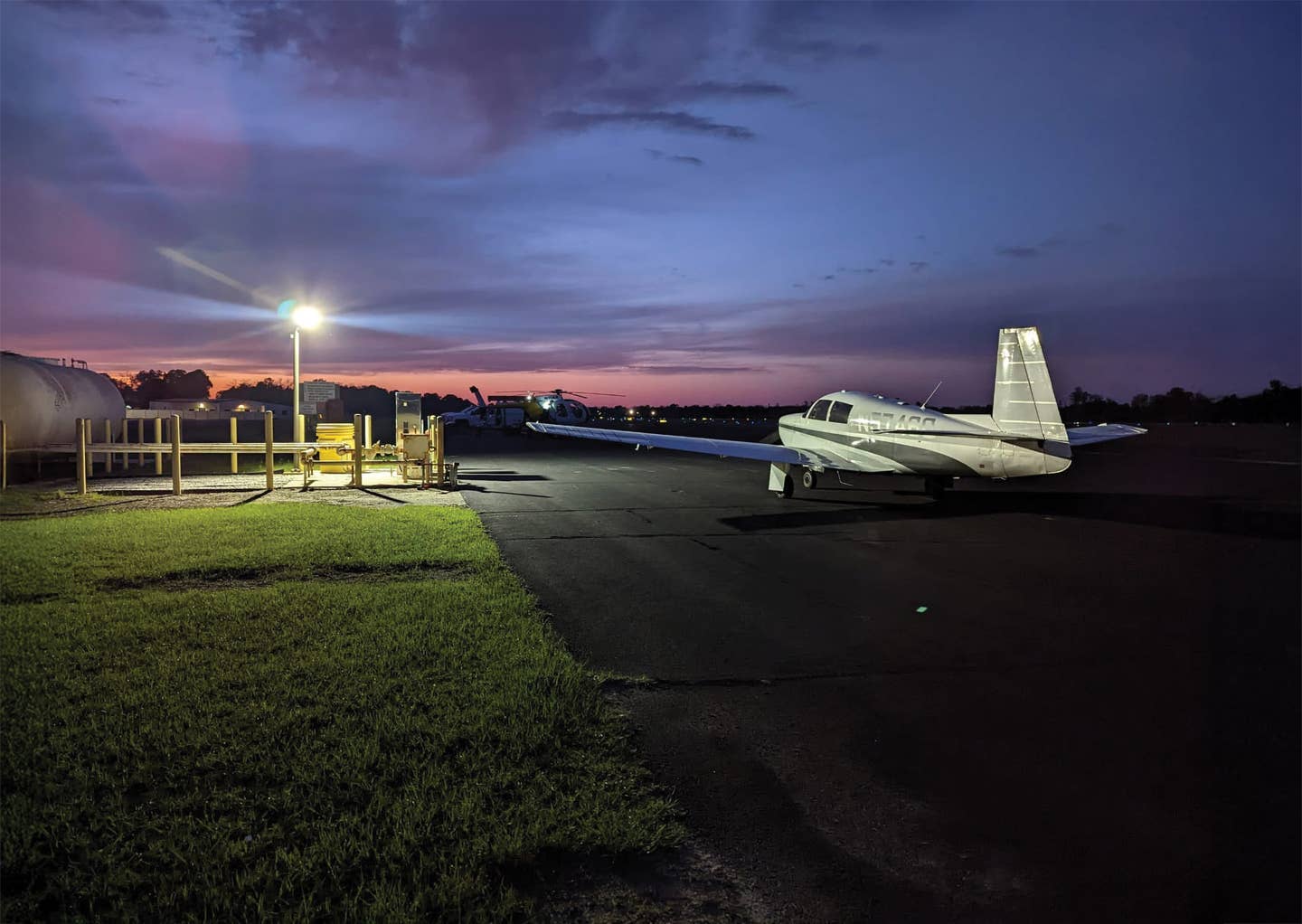
I fly a 2008 Mooney Acclaim Type S, purchased new in 2009 at a deep discount, thanks to the economic kerfuffle of the day. N781WB is a remarkable aircraft. Even parked on the ramp with its seven-degree nose-up stance, it seems to already be flying, and it evokes a tailwheel aircraft, which feels to me like aviation is supposed to feel. It's fast and efficient, and although Mrs. Levinson says that machines can't be beautiful or sexy, this one is both. It has speed brakes and TKS, approved for flight in known icing conditions. It's turbo-normalized with built-in oxygen, so the service ceiling is FL250, and I've had it to that neighborhood many times to ride the tailwinds---while keeping a close eye on our oxygen saturation, of course. With Monroy fuel tanks, it's good for more than seven hours, so the range is huge, even with the one-hour reserve I insist on.
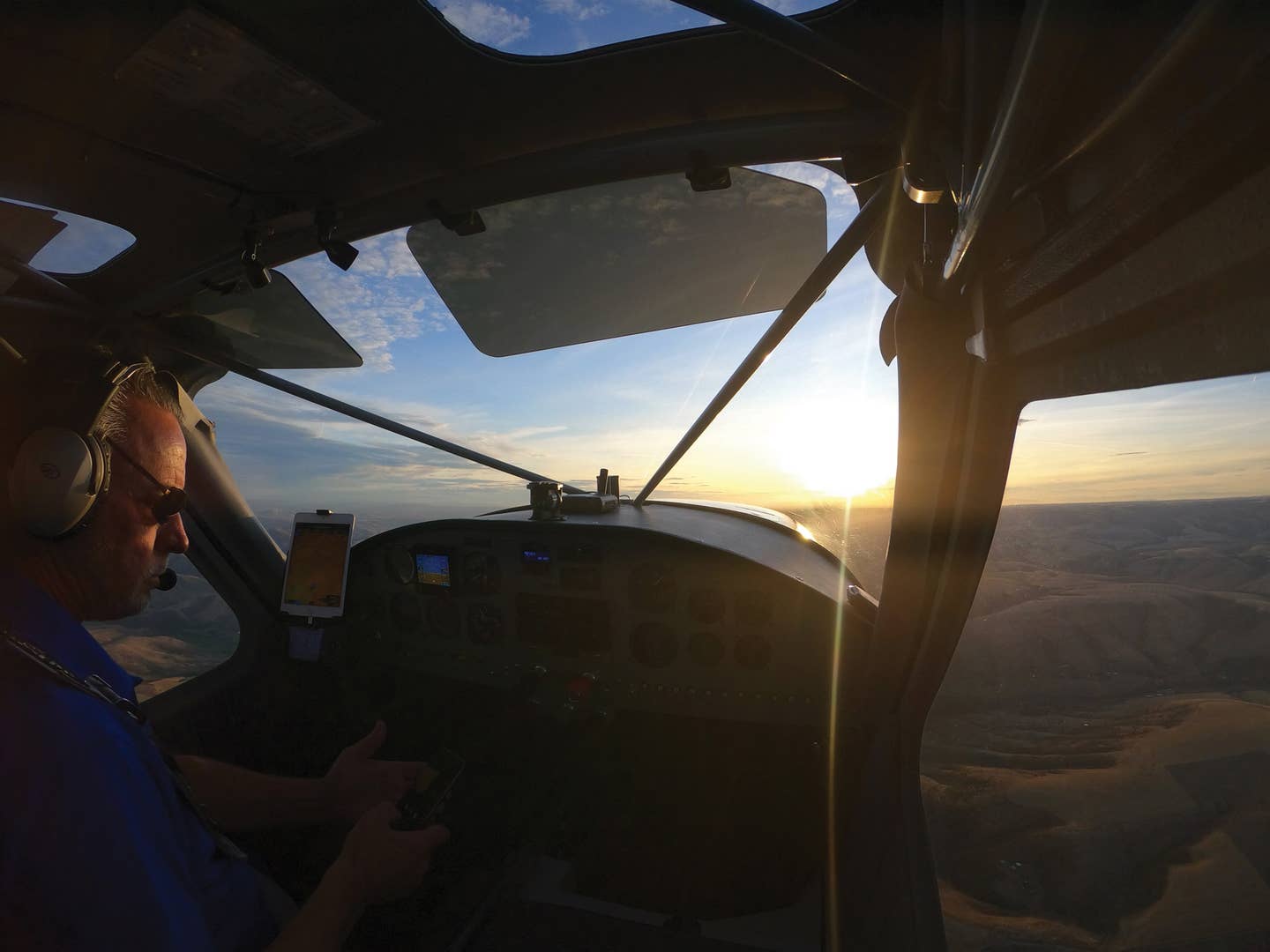
The panel is a Garmin G1000 with GFC700 autopilot, and I rounded that out a few years ago with ForeFlight and Jepp charts on an iPad. That iPad showed me things I didn't know I was missing and now can't do without, at least on serious cross-country trips. Moreover, the iPad Jepp charts come free with my panel ChartView subscription, providing redundancy I wouldn't want to fly without.
Balance is never a problem, but even though Theresa and I aren't large people, weight sure is. Maximum landing weight is 168 pounds under maximum takeoff weight, and I've built a spreadsheet for weight and balance and for weight-adjusted V-speeds at takeoff, mid-flight and near landing. The hard part with a Mooney is deciding what to leave behind.
 |
With such a wonderful flying machine, the bottleneck has to be the pilot, and as Clint Eastwood said through Inspector Callahan, "A man's got to know his limitations." I'm an East Coast flatland amateur pilot planning to fly the Rockies. We have some hills around here and even a few radio towers, which could probably reach up and grab you if you're being particularly brainless. We have some icy clouds too, but in the Northeast, we don't often have those obstacles converging from above and below at the same time. Mountain-associated turbulence is rare here, and high-density airport operations just don't happen. Happily, I enjoy the planning phase of a trip, and by today, I've thought hard about where to fly and how to do it as safely as possible.
Bedford To Bloomington
At 1353 local, we take off runway 29 at KBED into 400 broken, 1,300 overcast with TAFs predicting layers to the flight levels. I had filed IFR for 8,000 on a fairly direct route with four waypoints, but this is the Northeast, and that isn't to be. We get a full route re-clearance with six airways and seven waypoints. One of the best things about filing with www.fltplan.com is that you get a text message with your actual routing as soon as ATC shuffles and deals the cards. I plot my assigned route on the iPad with ForeFlight before leaving home, so I know it will work out okay. The only surprise I get in the cockpit from clearance delivery is the addition of the Hanscom 8 departure procedure. I brief the departure, enter the plan and then add Hanscom's ILS 29 to the end for use in case of an emergency on takeoff.
 Departing Hanscom Field in Bedford, Mass. |
Our path enters the deck a little under 1,000 feet, after which we climb in solid IMC. At 6,000, we emerge between layers then quickly go back into the clouds. OAT is 0 degrees C, but total air temperature is 4. We have no ice. Total air temperature shows, more or less, the result of air heated by friction and compression with the aircraft, and of course rises with airspeed. It's a much better predictor of ice formation than OAT. The equation for total air temperature would be no fun even with a calculator, but the G1000 does that for you on one of the AUX pages. We level at 8,000 in the soup, but not too long after, go visual between layers. As we fly west, the storm flies east, and the top layer evaporates. Later, the undercast dissipates altogether.
West of the Berkshires, on autopilot, I notice the turbine inlet temperatures fluctuating. The pattern is odd: slow swings up and down about 10 degrees. It takes me a minute to catch on. Airspeed is also varying and so is pitch attitude. It's subtle and gentle, but definite. I decide these must be small mountain waves, a phenomenon I've read about, but have never seen.
The trip to Bloomington takes 4.2 hours. Theresa says that's her maximum before getting itchy to throw off the headset. We review emergency procedures, and in her journal, she notes these considerations don't make her nervous. We talk about preparation for off-airport landings, and I have a checklist for her. She's to remind me to consider activating the ELT in the air and to ask me about propping open the door. Most importantly, she'll grab the small daypack of emergency supplies from the backseat---place that in her lap to shield her, and to make sure to bring that and nothing else out of the plane.
 Tied down on the ramp at Santa Fe, N.M. Tied down on the ramp at Santa Fe, N.M. |
Droning along in an airplane will never be Theresa's idea of a wonderful day, but pretty much any interesting destination is all she needs for inducement to strap on the Mooney. She loves the view from above and has an eye for the wonderful. Her photographs later make me understand just how remarkable our flight really was. It's not only visual. She's not much given to silence, and her comments are illuminating. It will remain a mystery to me why they always come just as we're entering a crowded traffic pattern or perhaps looking for a hawk called by the tower 100 feet over the approach end. Oh, well, she notices all the good stuff.
Theresa has never before made a radio call, so I have her do that. She calls in for a radio check and does just fine. ATC congratulates her afterward when I tell them it was her debut performance. As we near KBMG in Bloomington, I find something I haven't seen before. The weather, ASOS, is broadcast over their VOR frequency. I wonder why that's not the case more often. The wind is 160 at 12 gusting 20, and the runway in use is 17. I have trouble making out the airport in the near-sunset glare and ask for the GPS 17 approach. Cook Aviation's maroon awning is easy to spot, and they couldn't be more efficient or welcoming.
Friends had advised us to have dinner at Janko's Little Zagreb, and it's terrific. Tomorrow, we'll depart for Tulsa and beyond as we fly in Mooney-sized steps across the Rockies, into Southern California and up that dramatic coast before returning to the busy Northeast again.
 Final approach to Bloomington, Ind. |
Bloomington To Tulsa
The early morning ATIS at KBMG describes a clear sky with winds 270 at 14 gusting 21. The 6,500-foot runway 17-35 isn't going to work, but the 3,798-foot runway 24 is an easy winner. Even with the wind to help us, we have no choice except to fly much of this vacation at max gross weight, and while the Mooney is a phenomenal traveling machine, it's not too quick off the runway. Did I mention the tree-covered hills fairly close to the departure end? Calculations that cool morning afford a healthy safety margin, but even so, I elect a maximum performance takeoff. It's not a close call, but it makes for some great GoPro footage.
I expected takeoff into VMC with layers from 7,000 to 12,000, moderate turbulence and howling headwinds. Flying on top would be slow going and, anyway, as we worked our way west, the tops would climb and the ceilings would sink, engulfing us in IMC as we crossed a cold front with rain showers and scattered cumulonimbus to FL 350. The TAF at our destination, KRVS, predicted 040 at 8 knots, 5,000 overcast.
I had filed IFR at 8,000 with a simple route, direct SGF VOR entry point to the VINTA2 arrival procedure. While I could file such a simple route in the Northeast, I could never hope to actually fly it. ATC, in areas with such dense traffic, has no choice except to assign a much more detailed choreography if they're to keep all those radar targets from merging into an NTSB report. Here in the Midwest, I thought I just might get the simple routing, and that's the way it works out.
On initial climb, the headwinds are even more animated than forecast. As we approach 6,000, we have 40 knots on the nose, and it's worsening with every foot. ATC approves my request to remain there for the cruise. In visual conditions during the first half of the flight, we're treated to a fair view of St. Louis to our north and a great view of the Mississippi River and flood plain just below.
At about 1.6 hours into our 3.5-hour flight, near Springfield, Mo., we enter instrument conditions and, except for a few brief peeks, we're not to see the ground again until final approach. It's smooth and bland at first with plenty of green, but no yellow or red on the NEXRAD. Like all things in life, though, change is the only constant in cross-country travel. Pretty soon, a blossom of yellow appears well ahead of us on the MFD. It's right on our path and immediately before the SGF VOR. I'm not worried. It's yellow without red, and it's almost an hour ahead---plenty of time for it to move out of our way.
It doesn't move, though. It clings to that VOR and grows. Meanwhile, the rain picks up some and it gets a little bumpy. ATC allows 4,000, so we descend to smoother air and a few glimpses of the ground. The skies have the same idea, though, and descend to re-engulf us. That irritating cell is pretty big by now, but still yellow with no red. Oddly, ATC sees it differently, reporting moderate to extreme radar returns, and they vector us and everybody else around it.
our way.
There are some important differences between satellite NEXRAD and ATC radar. They see events in real time, while we have a delay that can be 15 or 20 minutes---a long time in convective weather. Also, our NEXRAD shows the worst case for each pixel of coverage. As a result, we see lots of examples where the NEXRAD looks worse than ATC, but not better unless the storm is growing fast, which must be the case here.
At KRVS, we're vectored onto the ILS 01L with winds 030 at eight knots, ceiling 2,200, 10-mile visibility. We break out at 1,600 feet and are asked to sidestep to 01R for equipment on 01L.
The naming of airports is a mystery to me. Every airport seems to have a name that's only known to itself, or maybe only to local pilots. KRVS is apparently called Riverside by ATC and everyone else. Nowhere, though, did I find it called Riverside in print. It's the Richard Lloyd Jones, Jr. Airport in Tulsa, and I guess if I had that name I'd ask people to call me Riverside, too.
The people at Riverside Jet Center are terrific and put 1WB to bed as we're met by one of my wife's six sisters and her husband. They take a lot of pride introducing us to Tulsa, and we enjoy a seven-napkin serving of ribs at Elmer's BBQ.
 Crossing the Mississippi River Crossing the Mississippi River |
Tulsa To Santa Fe
I awaken early to study the weather map for my first flight into high terrain. We'll fly toward a surface low, along a warm front and through a dry line just east of the Rockies. Fortunately, the system isn't very energetic. I expect to take off into a 2,700-foot overcast to emerge on top at 5,000 on our way to 12,000. Later, we will enter a zone of low-level wind shear and serious turbulence to the flight levels. The Santa Fe TAF predicts winds 240 at 20 gusting 30 at landing. That's a handful, but KSAF has three long strips of asphalt affording six compass headings, so the maximum crosswind potential isn't much. I file a mountain-sensitive route due west initially and then turning north after we pass the Sangre de Cristo peaks. Happy days as ATC again gives me what I ask for. I could get used to this.
The flight to Santa Fe turns out to be one of the nicest two-hour flights I've ever taken. Unfortunately, it's a 3.3-hour flight, and the last 1.3 hours aren't so nice. We climb from runway 19R into bases at 2,000, and then clear, smooth skies at 4,500. Passing through 10,000 for 12,000, I put on oxygen for the first time this trip. The nasal prongs are always a little uncomfortable, but I find that my oxygen saturation drops into the low 90s by about 10,000, and I feel better later after I've used oxygen. We have an O2D2 pulse delivery device from Mountain High, and it's outstanding. Oxygen isn't cheap, and it's not available at all FBOs. The O2D2 delivers oxygen puffs only when we inhale, so it has long since paid for itself. Also, you can feel each puff delivered, so there's no doubt it's working. Even so, I use that oximeter often and keep its batteries fresh.
I once read that flashlights can be defined as aluminum cylinders for the storage of dead batteries. I keep a ziplock bag of fresh batteries accessible in the plane. It's stocked for the CO detector, two flashlights, O2D2, emergency transceiver and pulse oximeter to all go dark at once. Every six to 12 months, I replace all the onboard batteries from that bag, take the used batteries home for ground-bound appliances and refill the bag with new.
The undercast clears as predicted. Oklahoma flattens into West Texas and then climbs into New Mexico. In my decade of flying, I've never become desensitized to the view from above. Exuberant summer, incredible New England autumn, dramatic snow-covered landscapes---but nothing like this below us now. It's terra incognita for us, and it's a great show.
Life is good at 12,000 until about 100 NM east of Amarillo when light chop begins. It's occasional at first, and I can't help thinking that, once again, an AIRMET T has overstated the problem. But, as mountains appear in the distance, the turbulence returns, builds and never loosens its grip. We've been through worse bumps, but we've never known such marked turbulence to persist for so long. ATC can only advise that it's worse higher and probably no better lower. Because of the MEAs, we can't try lower anyway until rounding the corner at RENCO onto V62.
The Mooney airframe is amazingly strong. Structural failure isn't going to happen. Theresa can't write in her journal or hold the camera steady, so she reads. I'm concerned that it might get bad enough to threaten control, so I run the list in my mind. Deploy speed brakes. Throttle back. Maneuvering speed. If bad enough, put the landing gear down. On V62, we leave 12,000 for 10,000, and life improves a bit.
KSAF is clear, landing on runway 20 with winds 230 at 23 gusting 31. All three runways intersect in a single point, and as I approach from the south, I misidentify runway 28 as my target, but then recognize the rookie error before entering the pattern and proving myself to be a moron with a pilot's license. We benefit from a new time zone, landing at 12:38 p.m. with lunch and lots of daylight ahead.
Theresa photographs the adobe control tower. We're met on the ramp by a woman from the Santa Fe Air Center who helps tie us down. Our rental car is right there, ready to load up. We've always been amazed by how often FBOs treat us in our tiny Mooney like rock stars in Gulfstream jets, and the people at Santa Fe are as good as the best.
It's a beautiful afternoon in a beautiful place. I'm actually excited to be out of the left seat for a bit to explore this town. Our next leg will be to Sedona, deeper into the mountains and on to other places we've always wanted to explore.
John Levinson practices and teaches cardiology and medicine at Massachusetts General Hospital and Harvard Medical School in Boston. He always wanted to fly, but couldn't find the time to start until well into his medical career about 10 years ago. An instrument-rated private pilot, he uses his Mooney for business and personal transportation. Look for Part II of the Levinsons' flying adventure in our next issue!

Subscribe to Our Newsletter
Get the latest Plane & Pilot Magazine stories delivered directly to your inbox

